The history of the city
The Grand Ducal Hessian historiographer J. W. Chr. Steiner began his book on the history and antiquities of the Rodgau, published in 1833, with the following introduction:
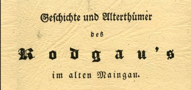
"The Rodgau, the ancient name of the area on the River Main, which today includes the villages of Niederroden, Dudenhofen, Jügesheim, Hainhausen, Rembrücken, Weiskirchen, Lämmerspiel and Hausen, was at the time of the Gauverfassung a much larger stretch of land than is now understood by this Rodgaue (Ruggau in common parlance). It extended almost over most of the area of today's district of Offenbach, or over the former Centen and offices of Seligenstadt, Steinheim, Heusenstamm, partly also Dieburg and Offenbach".
Historical finds
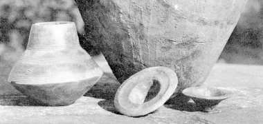
- 1600 to 600 BC - Finds from the Celtic period, the burial mound and urn field culture, suggest signs of early settlement in this heavily wooded area
- Romans stayed here until around 260 AD. A Roman grave discovered near Hainhausen bears witness to this. In addition to a sword and other objects made of ore, fragments of several urns made of fine greenish and white pottery were also found here
- After the retreat of the Romans, the first Frankish settlements began
First documented mention
At the time of the Frankish Empire in the 8th and 9th centuries, the surrounding forests belonged to the Dreieich game ban. Just like the "Kinziggau" and "Bachgau", "Der Rodgau" was part of the "Maingau", which was not a political entity but rather a landscape demarcation.
Around the time of Charlemagne, nuns founded a monastery near Ober- and Nieder-Roden.
The first documentary mention of the "Rodgau" in 786 AD in the Codex Laureshamensis also refers to this. The Lorsch Codex states that the monastery "Raodora" (later also called "Rotaha") bequeathed to Lorsch Abbey was located in the "Raodora Marc(h)a", i.e. in the district or margraviate of "Roden". The name could go back to the "settlement on a cleared floodplain", but also to the fact that the Rodau, which flows through the Rodgau and has its source near Urberach in the Rotliegend, used to turn red when it flooded. It is still not known exactly where the monastery was located.
History of the town of Rodgau and its neighbourhoods
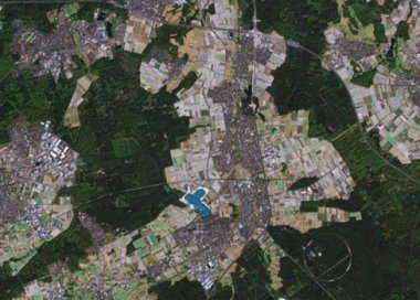
On 1 January 1977, as part of the Hessian regional reform, the municipalities of
- Weiskirchen
- Hainhausen
- Jügesheim
- Dudenhofen
- Nieder-Roden
- and the Rollwald settlement belonging to Nieder-Roden
the large municipality of Rodgau, which was granted city rights on 15 September 1979.
The old Gewann designation "Rodgau", like Bachgau and Kinziggau belonging to the Maingau, gave the town its name. Formerly not an administrative unit but merely a landscape designation, it gave the name Rodgau to the large municipality and later town (from 1979), which was created in 1977 through a merger. The railway line from Offenbach to Reinheim, which opened in 1896, was historically called the "Rodgaubahn" from the very beginning, in reference to the district it served.
Original municipalities
The original communities have a history stretching back many hundreds of years.
Weiskirchen district
The settlement of "Wichenkirchen" or "Wizzinkirchin" developed around today's ancient St Peter's Church, which also gave the village its name, in Frankish times at the latest.
The village was first mentioned in documents in 1215, when the Seligenstadt monastery reached a settlement with the communities of the Auheimer Mark. The lords of Hagenhausen, who had their ancestral seat in the immediate neighbourhood in today's Hainhausen, were initially the sovereigns.
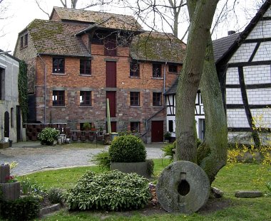
As the Lords of Eppstein - as they were later known - they sold Weiskirchen to the Archbishop of Mainz in 1425. Until 1803, Weiskirchen's affiliation to the Electorate of Mainz had a decisive influence on the municipality. As the ecclesiastical centre for the parishes of Jügesheim, Hainhausen and Rembrücken, Weiskirchen was of supra-local importance and, with its five mills in Rodgau, also enjoyed a prominent economic position.
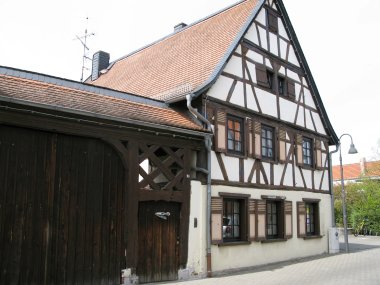
The nearby Grand Ducal factory town of Offenbach brought about the decisive transformation of Weiskirchen from a farming village to a working-class community in the 19th century. Until the beginning of this century, the village was still characterised by half-timbered buildings, but later the facades were replaced by stone walls and many half-timbered houses had to make way for new buildings.
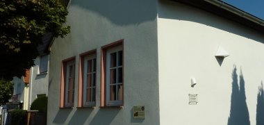
Today, only sparse remnants of what was once the "most beautiful half-timbered village in the Offenbach district" remain. After the period of the so-called Third Reich, which led to the dissolution and expulsion of the small Jewish community in Weiskirchen with its small prayer house on the main street, the settlement of refugees and displaced persons and the designation of further new housing estates and an industrial area led to successful growth after the war.
Hainhausen district
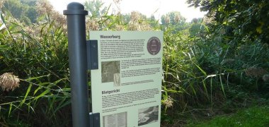
The smallest district of Rodgau was first mentioned in a document in 1108 as the site of a moated castle belonging to the Lords of Hagenhausen, whose moat was fed by the Rodau.
Following geophysical prospection in 2010/11, the remains of the castle walls were discovered during excavations in 2012 under a meadow near the Rodau on today's Burgstraße. The Hagenhausen family, who helped write a piece of German medieval history as the "Eppsteiner" after moving to the Taunus, gained great importance and power from the 13th century onwards. The lords of Eppstein alone provided four archbishops of Mainz. However, the first ancestral seat of the Eppsteins did not benefit from the splendour of the descendants of the former lords of the castle.
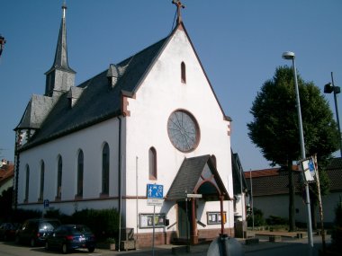
The village reached its lowest point during the Thirty Years' War and shared the fate of the neighbouring communities when the plague raged among the population. The end of the plague, after the last few survivors had prayed to the plague patron St. Roch for help, is still celebrated every year with a procession - also from Weiskirchen - on 16 August. The destination of the procession, St Roch's Chapel, which was consecrated in 1692, was replaced at the end of the 19th century by the new construction of St Roch's Church, which was last extensively renovated and extended at the end of the 1970s and is a historical gem with art treasures in Rodgau.
Jügesheim district
While the other four districts of Rodgau developed from street villages, Jügesheim was founded in the middle of this landscape along the Rodgau as a so-called clustered village. The first documentary mentions date back to the period from 1189 to 1220.
A bailiff of Charlemagne called Gugin - or Guginhart - is said to have given the settlement its name. In the Middle Ages, Jügesheim belonged to the tithing court of Nieder-Roden and Rödermark. After the Thirty Years' War, the village was almost extinct. The few remaining families lived temporarily in the Seligenstadt forest.
It was only in the last half of the 17th century and in the 18th century that the village revived, where the leather goods industry - with a large proportion of homeworkers - later flourished alongside agriculture.
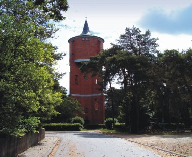
Even today, Jügesheim in particular has internationally renowned companies in this sector, which helped to establish the good reputation of "Offenbach leather goods". The construction of the Rodgau railway in 1896 contributed to the upswing at the turn of the century, which of course also connected the other communities to the Offenbach/Frankfurt centre and greatly promoted economic development.
Agriculture is still practised in Jügesheim today - primarily from resettler farms in the western and eastern neighbourhoods. The industrial estate in the east was not designated until the mid-1970s and was extended to the south in 1989.
With the construction of the new central town hall in the centre of Jügesheim, the town of Rodgau did justice to Jügesheim's natural location in the middle of the new community.
Dudenhofen district
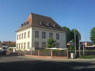
Dudenhofen was first mentioned in a settlement between Archbishop Werner of Mainz and the Lords of Eppstein in 1278. The village was divided for a long time, with individual parts of the village being inherited and others being exchanged for land elsewhere or given as a pledge along with all the inhabitants.
Among the neighbouring communities, today's districts, Dudenhofen had a special historical development in the Middle Ages. Between 1450 and 1736, Dudenhofen was assigned to the County of Hanau and the Babenhausen office. The fate of the village was therefore closely linked to that of Babenhausen.
Apart from the long-established Jewish Reinhardt family, who were expelled from the village in 1938, the population was purely Protestant. Dudenhofen formed something of a Protestant enclave in the midst of the otherwise Catholic neighbouring communities in Rodgau.
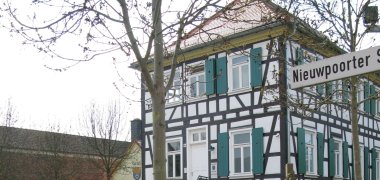
In the 18th and 19th centuries, the purely agricultural structure of the village no longer provided a livelihood for all its inhabitants, so young men and families in particular emigrated to the "New World" in North America, where they sought - and in some cases found - their fortune.
Although it is still embedded in fields and blessed with one of the largest municipal forests in Hesse, agriculture has lost its importance in Dudenhofen, where there is no longer a single full-time farm. Only the cultivation of asparagus on the sandy soil, which is well suited for this purpose, has survived. Dudenhofen asparagus is considered a speciality. The cultural life in Dudenhofen and the solidarity of the people of Dudenhofen remain unique to this day.
Nieder-Roden district
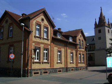
The name of what is now by far the largest district of Rodgau could go back to the "settlement on a cleared floodplain", but more likely to the Rodau (formerly Rotaha = red water) that flows through the village, which has its source near Urberach in the Rotliegend and used to turn red at high tide. Nieder-Roden was first mentioned in a document in 786, when the Rotaha monastery was bequeathed to Lorsch Abbey. However, there is still no conclusive information about the location of the former monastery near the Rodau in the area of today's Nieder-Roden and Ober-Roden - part of the neighbouring town of Rödermark.
Finds prove that Nieder-Roden was already a settlement area in the centuries before the birth of Christ. Some of these artefacts, witnesses to a perhaps great prehistoric past, are part of the exhibits in the local history museum in Turmstraße. Nieder-Roden achieved great importance in the Middle Ages as the seat of the tithe court, among other things, and belonged to the Archbishopric of Mainz from 1425 to 1803.
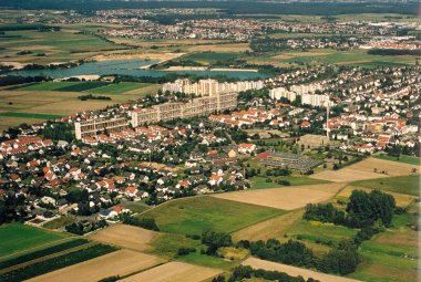
After the Second World War, Nieder-Roden experienced the most dynamic development of the neighbouring communities in Rodgau. From just under 3,000 inhabitants in the 1950s, Nieder-Roden grew by more than 10,000 to its current population of around 14,000. In addition to large residential areas to the west of the railway, a large industrial area with a railway siding and in the immediate vicinity of the new B45 federal highway was also designated to the east, where global companies such as IBM also settled.
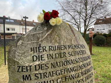
Nieder-Roden was the only municipality in Rodgau to belong to the district of Dieburg until the territorial reform in 1977, while the four neighbouring municipalities to the north were assigned to the district of Offenbach, to which the town of Rodgau also belongs today. The Rollwald district was only created after the war, partly on the site of a penal and later prison camp set up there during the National Socialist regime.
Nieder-Roden is known beyond the borders of Rodgau not only for its 400 metre long high-rise wall, popularly known as the "Chinese Wall", but above all for its bathing lake, which has been transformed from a gravel lake into a popular lido with a nudist section and is still being expanded.